
Jurisdiction: Abandoned Mine Lands
2005 Completed Projects Archive
Leith AML Project
The Leith AML Site is comprised of 45 acres of surface and underground mines located in Grant County, Sections 1 and 2, T133N, R88W, and Section 7, T133N, R87W, approximately one to two miles west of Leith, North Dakota. The area was mined in the early 1920's through the mid 1960's.
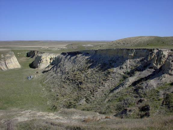
The Leith AML site was characterized by a series of sink holes, vertical openings, highwalls, and adjoining spoil piles. The mines contained numerous areas of subsidence resulting from underground mining of lignite coal. The highwalls in places approached vertical elevation drops in excess of 70 feet. These mines constituted a dangerous situation to hunters and landowners that used the area. Snow cover during fall and winter presented an inherent danger on and around the vertical openings, sinkholes, highwalls and spoil piles.
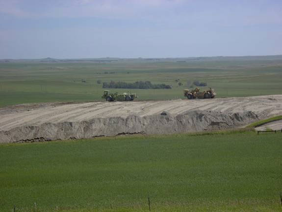
The Leith project entailed the elimination of 5000 feet of dangerous highwall left at the old surface coal mines. Reclamation work on this site started on May 16, 2005. Project Manager and Engineer for the project was Mark Knell. The contractor, Quality Construction Inc., moved approximately 187,000 cubic yards of soil material to eliminate the hazardous highwalls from a 40-acre area. The contractor utilized a fleet of construction equipment, which included scrapers, dozers, and front end loader. An approximate 5-acre subsidence area was also reclaimed. The sink holes were filled and topography regarded to control water and prevent erosional problems. Topsoil material was salvaged prior to spoil dirt work operations then respread following completion of the dirt work. At the end of July 2005 the dirt work at the Leith project was completed. The project area was fertilized, seeded and mulched August 1- 9, 2005. Larry Reisenauer inspected the project. The project was completed for $229,783.75. Trees will be planted on the site next spring. The attached photographs show a small portion of the reclamation areas.
- Leith before reclamation (45kb pdf)
- Leith after reclamation (26kb pdf)
Beulah/Zap Phase IX AML Project
The 2005 Beulah/Zap Phase IX abandoned mine reclamation site was located along Mercer County Highway 13 within T144N, R89W, Sections 23 and 26 about 1 mile south of Zap. This project represented the second phase of underground mine reclamation at the Zap AML site.
The Zap site along County Road 13 represents an approximate 1 mile section of road that was undermined by the abandoned Lucky Strike Coal Mine, Dry Flint Coal Mine and possibly other smaller abandoned underground lignite coal mines. The Lucky Strike mine operated from approximately 1917 To 1937 and produced over 600,000 tons of coal by the room and pillar method of underground mining. The Dry Flint Coal Mine operated from approximately 1921 to 1927 and production figures indicate that approximately 10,000 tons of coal was produced from this mine.
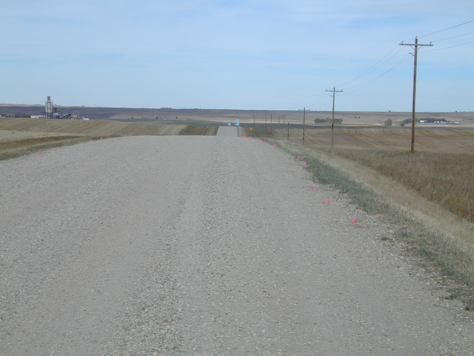
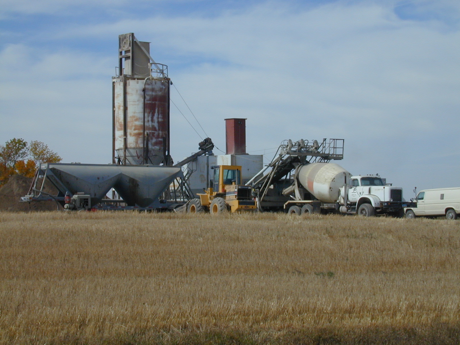
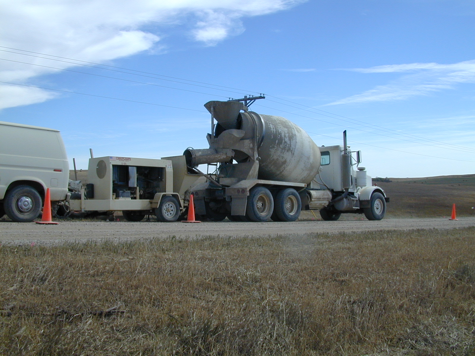
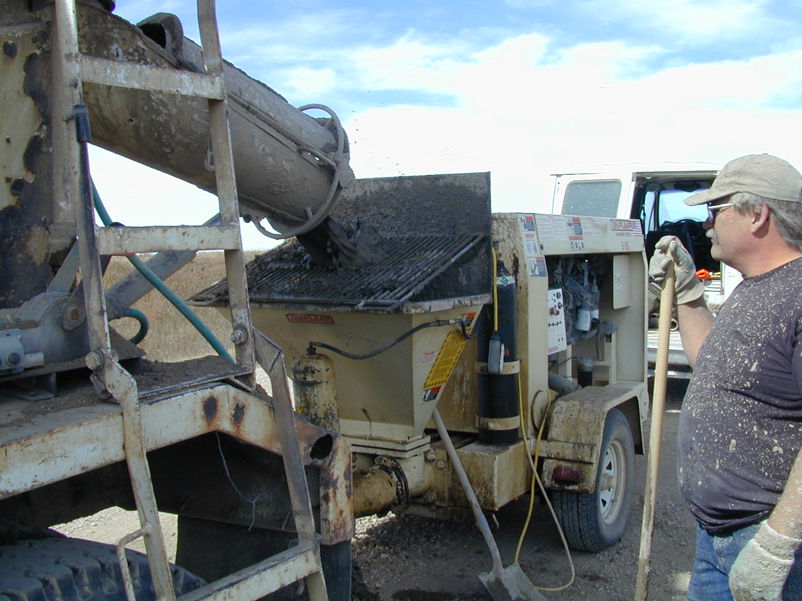
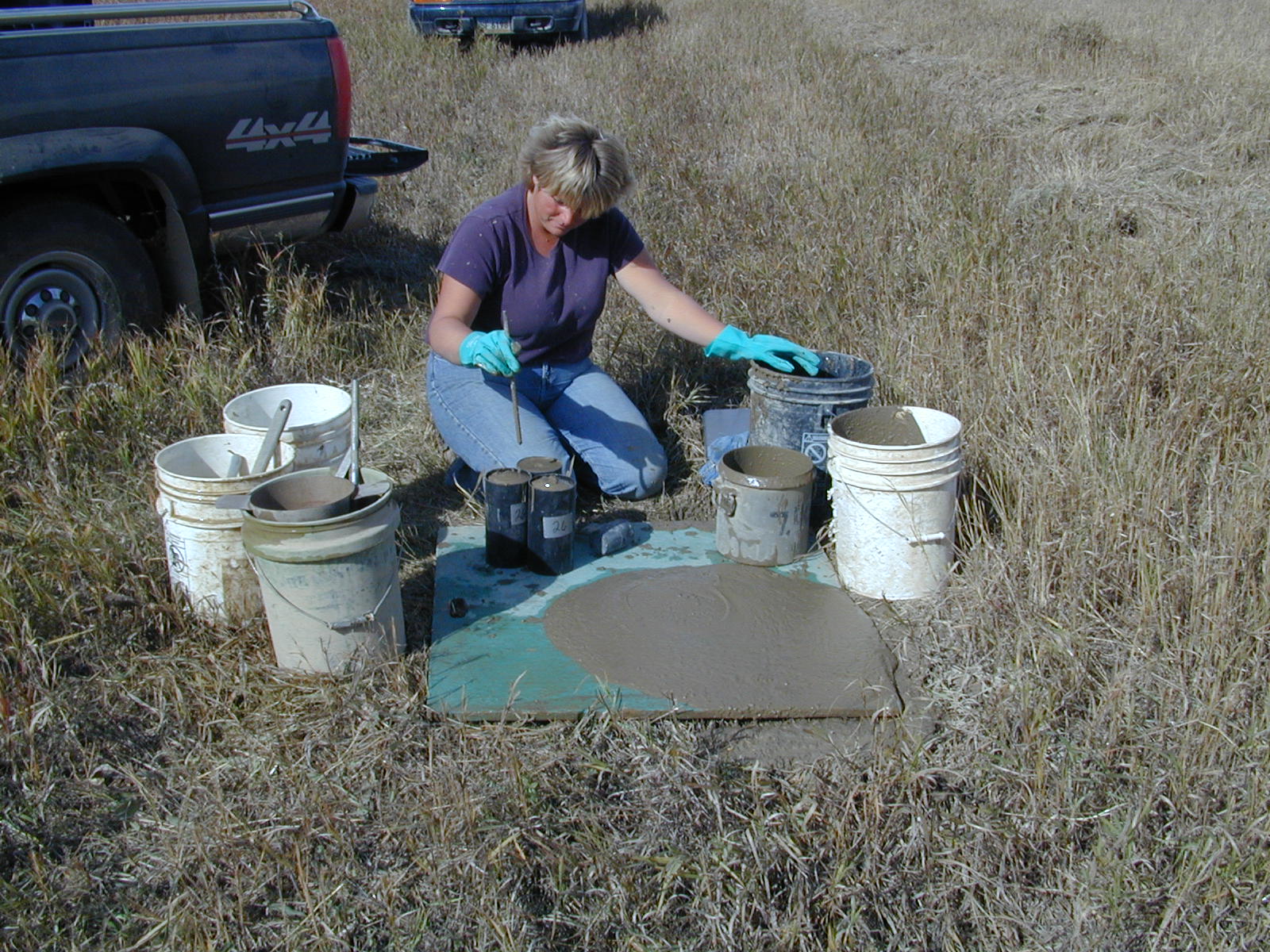
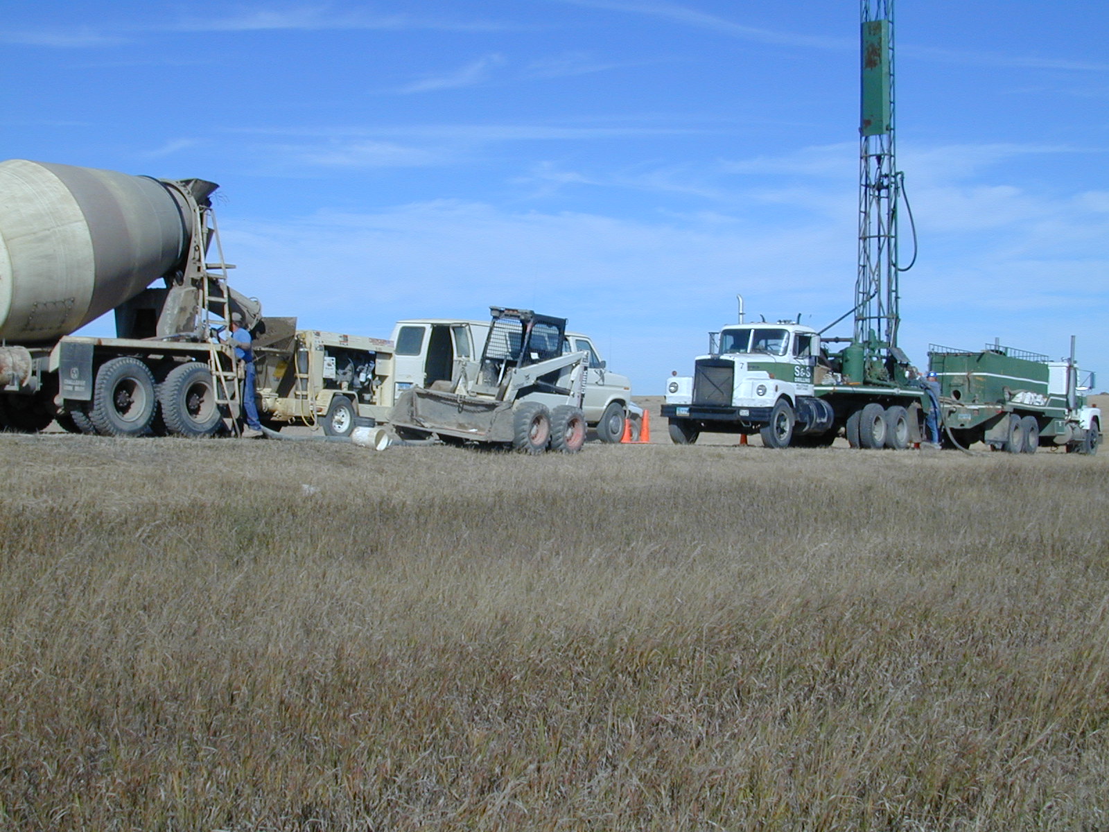
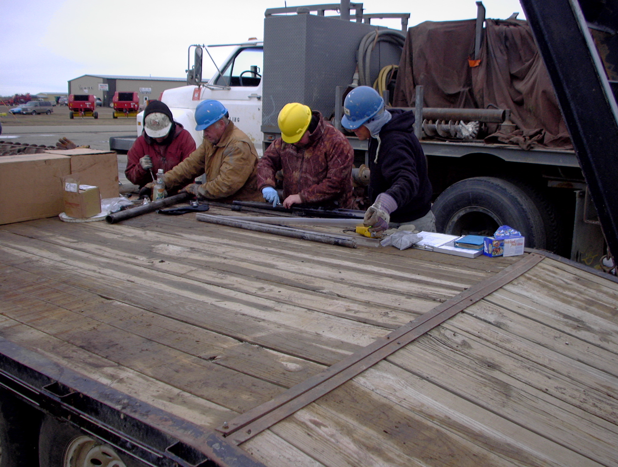
Attention was focused on this site in 1996 when reports of sinkholes in the road and road ditches were reported to the PSC by the Mercer County Highway Department. Exploratory drilling indicated a substantial portion of County Road 13 to be undermined. The reclamation method used for this project was pressurized grout remote backfilling. In this method, grout is pumped under pressure through drilled holes into the underground coal mine workings. The grout material flows into mined cavities and helps reduce the likelihood of mine collapse and the formation of subsidence or sinkholes.
A total of 3,824 cubic yards of grout was pumped into underground mine voids and collapsing (rubble) areas. An additional 270 holes (borings) were drilled at the site in 2005 and those that encountered mine workings were cased with PVC pipe to be used as a conduit for grout injection next year. Several sinkholes located in adjacent pastures and one within the road right-of-way were backfilled with dirt as part of the project.
It is expected that one additional phase of grout injection will be required to finish work along County Road 13 and that project is expected to begin or about June 1, 2006. Pictures include:
- pink stake chasers indicate areas where mine voids were drilled and cased (382kb pdf)
- batching a load of grout (403kb pdf)
- pumping grout into the underground coal mine (407kb pdf)
- close-up of pumping a load of grout into the underground coal mine (395kb pdf)
- an engineering firm is hired to test many aspects of the grout in 50 cubic yard increments (439kb pdf)
- grouting and drilling operations (413kb pdf)
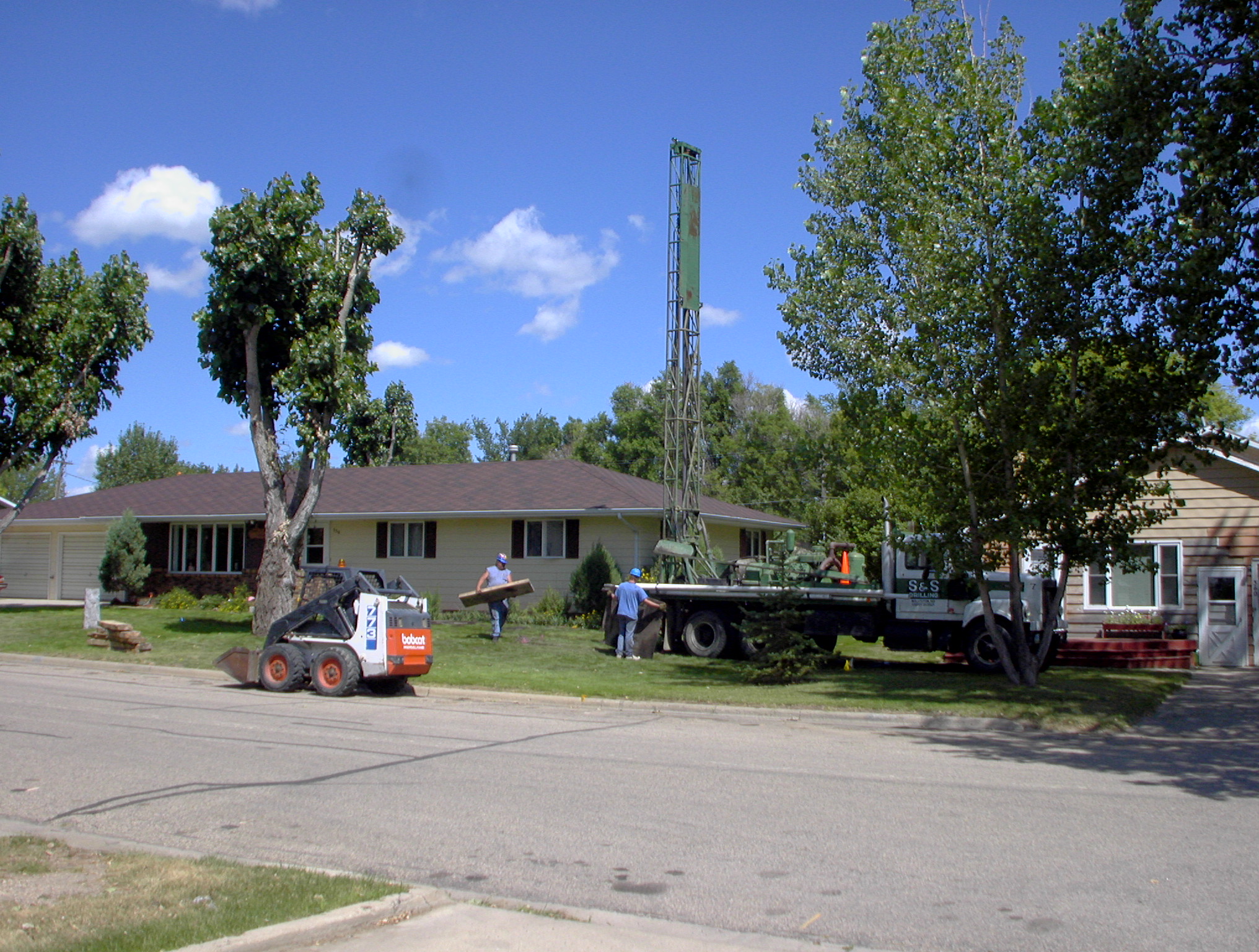
Garrison Phase IV AML Project
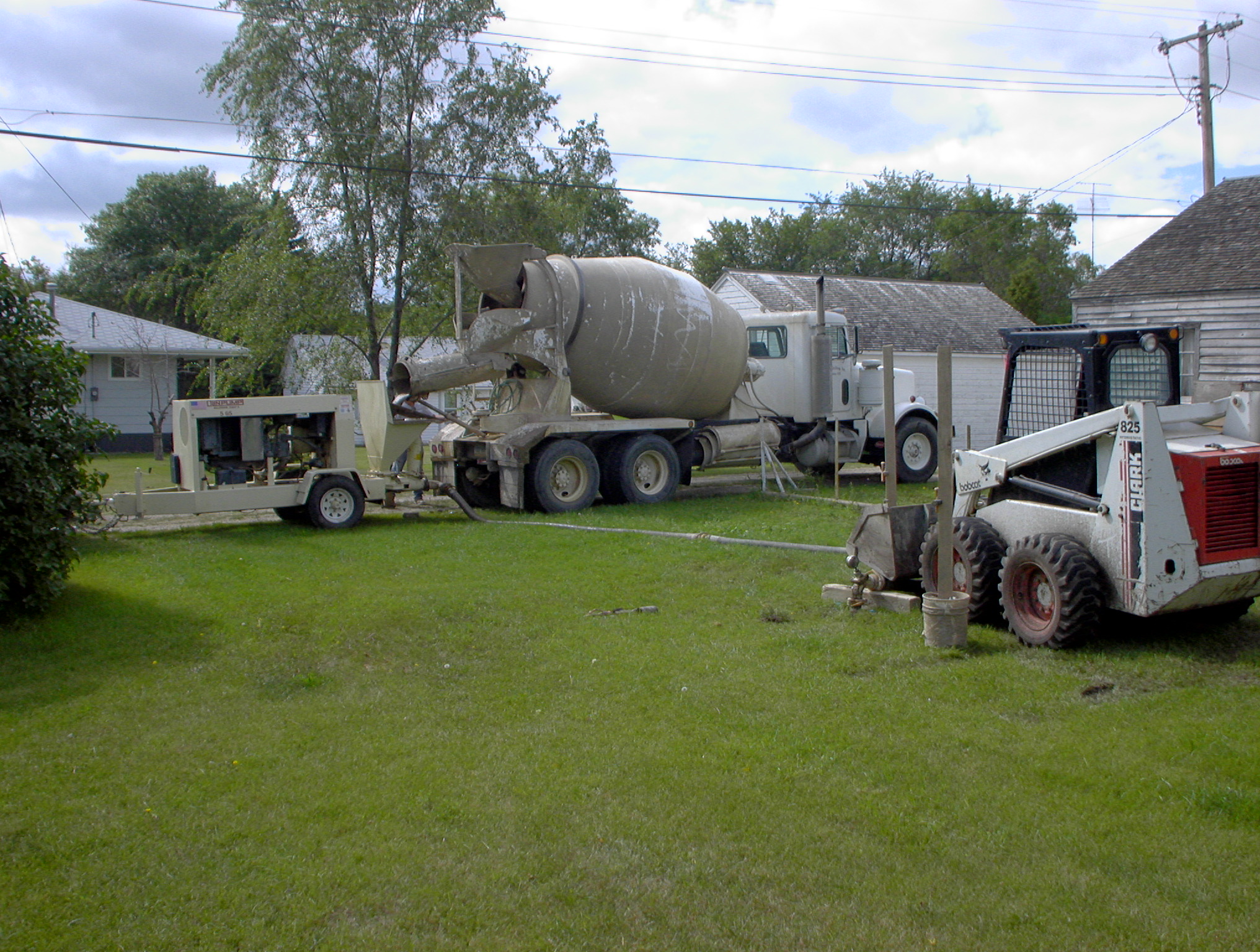
The 2005 Garrison Phase IV abandoned mine reclamation site was conducted at residential areas, city streets and highways at Garrison, ND. This project was the fourth of a four-year project of drilling and subsurface mine reclamation to address the highest priority undermined areas at Garrison. The reclamation method used for this project was pressurized grout remote backfilling. In this method, grout is pumped under pressure through drilled holes into the underground coal mine workings. The grout material flows into mined cavities and helps reduce the likelihood of mine collapse and resultant subsidence or sinkholes.
Dangerous sinkholes have been a frequent problem for the residents of Garrison (population 1318) as shallow abandoned underground coal mines have deteriorated with time and collapsed. At least two major highways and three residential and commercial subdivisions at Garrison are underlain by relatively shallow abandoned underground coal mines. These include the Garrison Coal Mine, Rupp Mine, Quality Coal Mine, J. A. Kunkel Mine and others. A deep sinkhole that opened along McLean County Highway 15 in 2001 focused special attention on the hazards of abandoned underground mines at Garrison.
The 2005 Garrison project ended with a surprise when fresh gasoline was discovered in an underground mine void. This was traced to a leak of approximately 30,000 gallons from an underground storage tank at a nearby gas station. This finding was turned over to the North Dakota Department of Health and was being investigated at the time of this writing.
Summary statistics about reclamation work conducted at Garrison are contained in the following table, followed by photographs of reclamation.
| Year | Drilling (ft) |
Casing (ft) |
Grout (cu. yds.) |
Contract Costs |
|---|---|---|---|---|
| 1983 (Sinkholes) | $16,237.75 | |||
| 1997 (Expl. Drill) | 11371 | 493 | $ 24,426.80 | |
| 1999 (Sinkholes) | $4,124.88 | |||
| 2002 (Phase I) | 22062 | 1597 | 1055 | $120,939.76 |
| 2003 (Phase II) | 20100 | 4460 | 0 | $ 55,000.00 |
| 2004 (Phase III) | 14585 | 2870 | 1720 | $217,069.70 |
| 2005 (Phase IV) | 17985 | 534 | 2024 | $304,223.50 |
| Total | 86103 | 9954 | 4799 | $742,023.39 |
- Drilling in a residential area at Garrison in 2005 (959kb pdf)
- Grout injection in Garrison in 2005 (966kb pdf)
- Environmental drilling to trace gasoline leak in Garrison, 2005 (880kb pdf)